Embark on your outdoor adventures with unyielding confidence using Mapitare, the comprehensive terrain and sea mapping solution tailored for those who embrace the great outdoors. Whether you’re an enthusiastic hiker, hunter, or boater, this digital mapping application ensures that you remain oriented and secure in your environment.
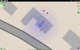
The key highlight of this solution is its robust offline functionality. With the entire map data pre-downloaded onto your device, users have the invaluable advantage of precise, quick navigation without the dependence on fragile cellular or data connections. A visual indicator representing your real-time position assists in navigating, significantly diminishing the risk of disorientation, especially during inclement weather or within challenging terrains.
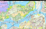
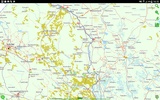
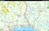
One of the strong suits lies in its comprehensive coverage, which spans across the expansive land and sea territories of Finland, Sweden, and Norway, with ambitions to extend even further. It integrates a variety of authoritative data sources, from National Surveys and Road Management to OpenStreetMap and Maritime Administration, for an encompassing, detailed mapping experience.
For enhanced interactivity, there's the functionality to form groups and track travel companions in real-time—a feature especially helpful for team expeditions or family outings.
Unparalleled mapping precision extends to the exactitude of centimeters, reflecting a level of technological prowess developed over fifteen years. The services provided are independent of external suppliers, which ensures not only cost-effectiveness but also complete control over updates and improvements for users.
With a starting opportunity to explore its full features for a free trial period, the app stands as an indispensable tool for individuals requiring a dependable guide in their quests through nature's myriad pathways.
Requirements (Latest version)
- Android 4.4 or higher required


Comments
There are no opinions about Mapitare yet. Be the first! Comment